
The True Size of Africa
I don't know about you but I was amazed when I saw this map. I never realised Africa was so big. But then again, geography never was my strength at school.
7 Answers
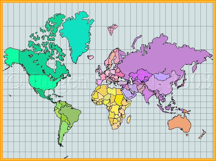
The problem with the Mercator projection is that originally was useful for navigation, because it preserved the angles at the expense of large deformations in shape and size. All 2D projections have to sacrifice something: correct angle means unrealistic area; realistic shape also comes with unrealistic area, and realistic area comes with slight shape distortion, and bad angles. There are more than 100 types of projections. The Robinson and Wikel III projections are two commonly used projections with an overall good compromise.
Mercator projection (progressively distorted; infinite distortion at the poles)


Robinson projection (only significantly distorted at the poles)

Winkel tripel projection (significant distortion only at the poles)

Mollweide projection (shape distortion, but correct areas!)

TsNIIGAiK projection (least distortion characterization, but not popular)

Your wrong impression of the sizes of continents is mostly due to the over-use of the Mercator Projection, so often used in schools.
Land masses are exaggerated more, the farther from the equator they lie. Africa is as close to the equator as you can get. Greenland looks bigger than Africa.
?South Sudan will declare its independence on July 9th, 2011 and it is expected to become the newest sovereign state in Africa and in the world.

?Someone has called for the creation of "the United States of Africa". If this idea is completed, Africa will pass the Russian federation to become the biggest sovereign state in the world by area.
The African Union is playing an important role in the unity and integration of Africa.

?The European Union also has territory located in Africa (there are 5 European countries whose integral parts are located in both Africa and Europe).
But then again, geography never was my strength at school.
I have always loved geography. I am horrible at following a road map, but love seeing where different countries and places are in the world and how their location and proximity to other countries plays a part in their culture. I am constantly checking world/country maps.
Imagine my surprise when I first opened your link to see that France, Spain, Germany and Italy were a part of Africa.  It took me a minute, but I now understand the illustration and it is amazing. Thanks Eddy.
But then again, geography never was my strength at school.
Nor mine . I remember a teacher pointing to a map and saying "what country is this?" and I had no idea... the answer was Africa  .
To be fair, I thought she was pointing to a specific country *in* Africa .
The Southern Hemisphere (countries) of the Earth is larger than the Northern Hemisphere. The drawing of the maps were skewed to a larger size for the Northern Hemisphere due to the arrogance of the superior view of the white male population of the time.
If you look at maps of over a century ago you will note that the British Isles were drawn much larger than it really is: the pre-eminent country of the era.
Map drawing was a sop to the ego in charge at the time: white, (upper) middle class male.
Wow! That's truly fascinating. I never knew that, either.
Here are some facts about Africa.
- The population of the entire continent is 800 million.
- There are 53 countries in the continent.
- The largest country in Africa is Sudan.
Shakira - Waka Waka (This Time for Africa)


